RiskMap
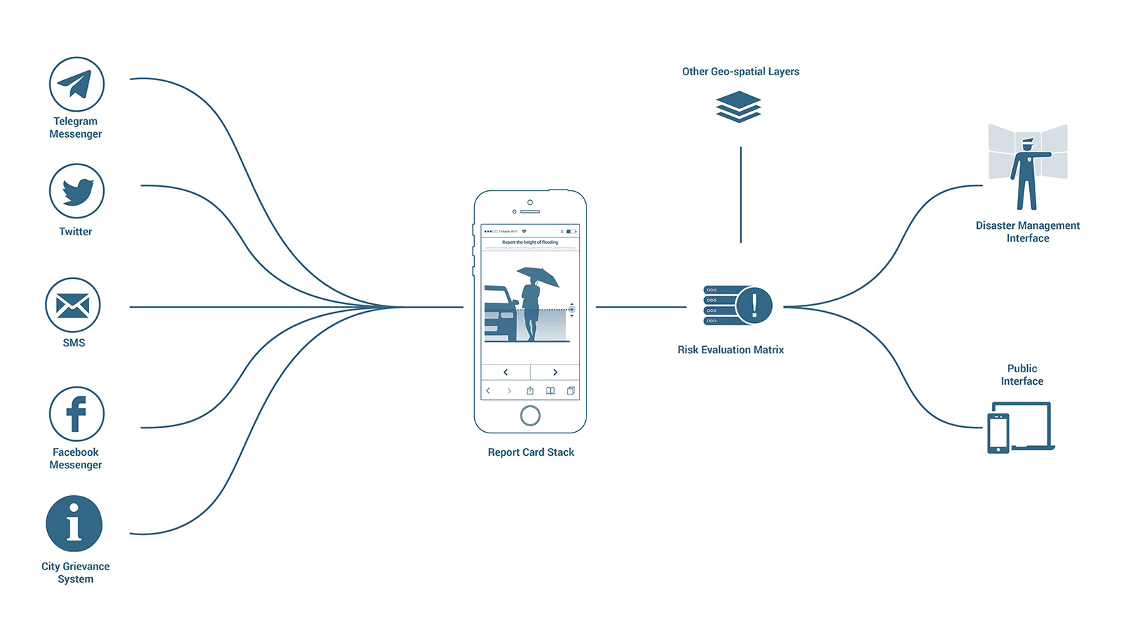
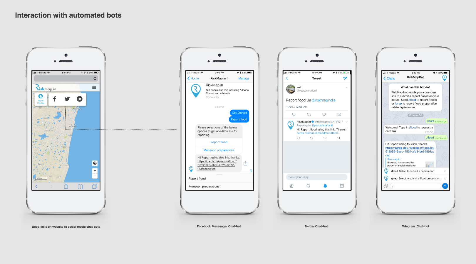
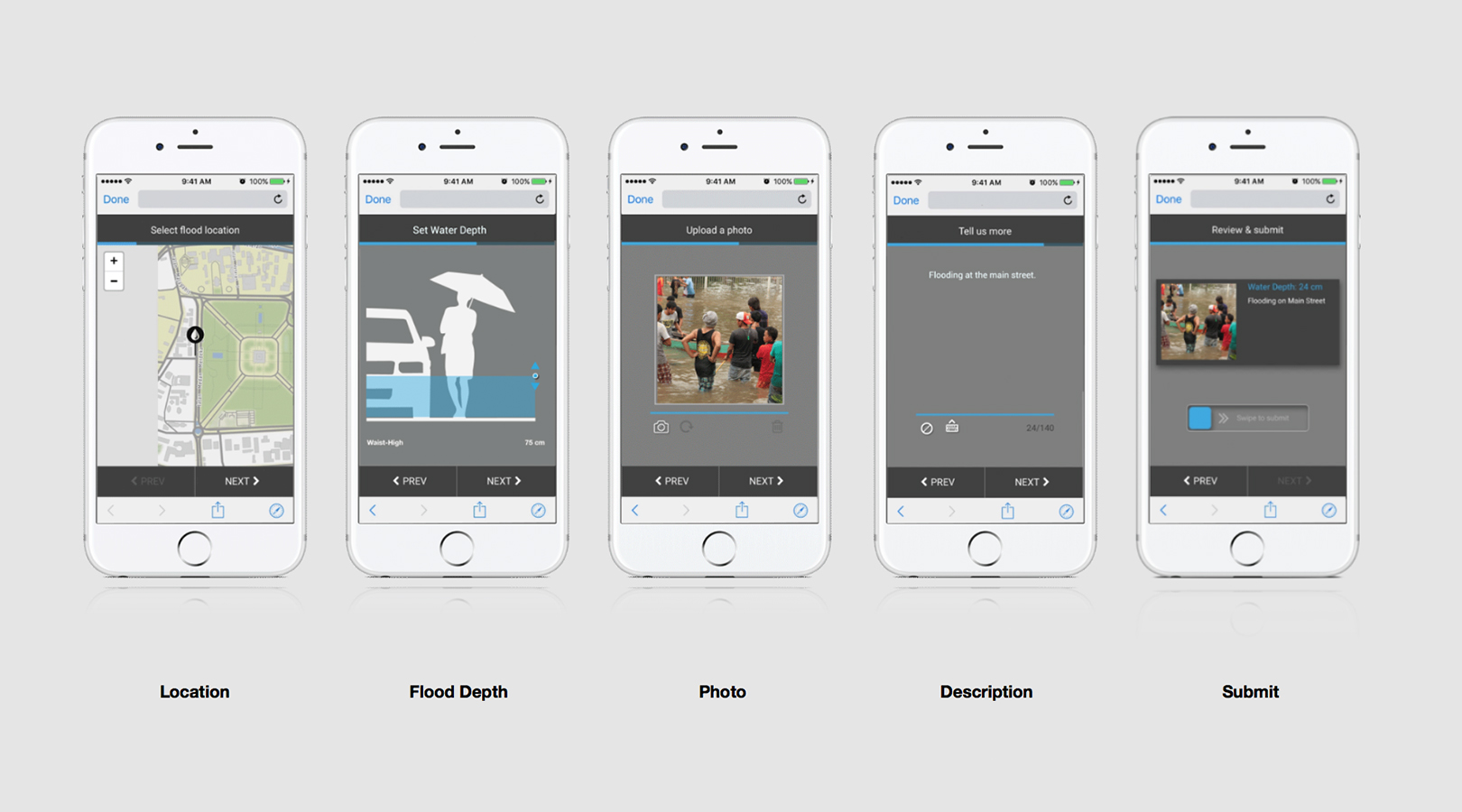
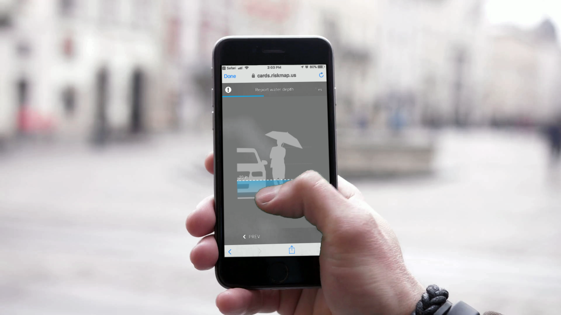

Urban Risk Map harnesses the power of citizen reporting and social media to map time-critical information without needing to install any new applications or training. Currently operating in three countries - Indonesia, India and the United States - this platform connects residents, who often have the best-localized information, with emergency managers to drastically cut down on response times. Through the live map, residents are also able to inform each other about dynamically changing situations in the city and help each other navigate to safety. The platform currently works with Twitter, Facebook, and Telegram and also visualizes real-time sensor information, such as changing water levels in flood gauges, monitoring wells and pumping stations.
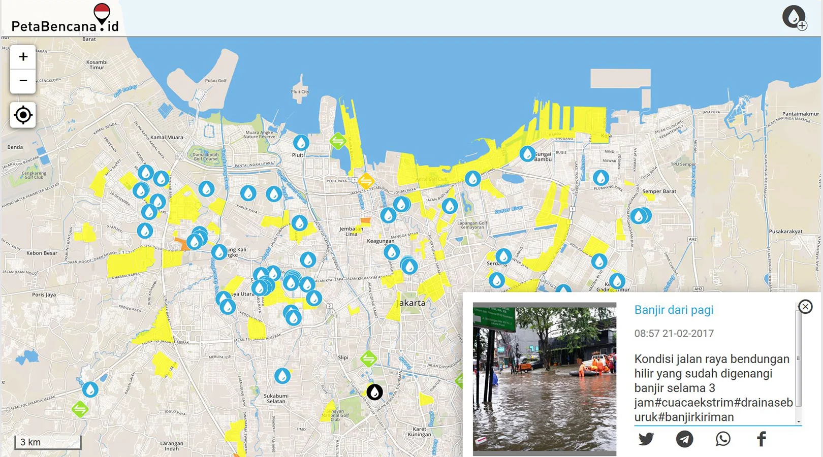
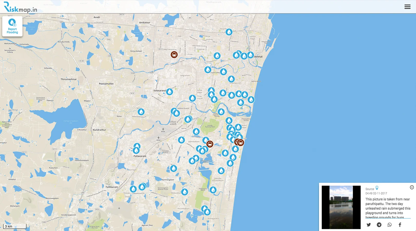
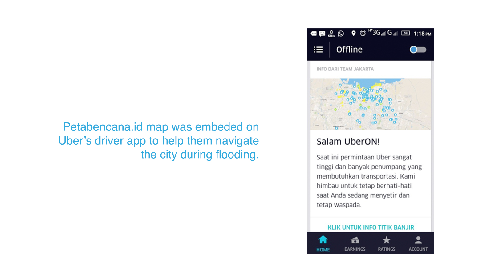
This platform was widely shared and used during high-intensity rainfall event in Jakarta on February 21, 2017, when over 300,000 residents used the website to navigate the flooded city. The public map was also embedded in the Uber app for drivers to help them travel safely through the city. Similarly, in Chennai during a high-intensity single day rainfall event on November 2, 2017, the Riskmap.in website received 1152 page views a minute at its peak and 111,808 page views in 24 hours.
Current research work also focuses on extending the system beyond flooding to include multiple hazards types and developing custom decision support tools for the governments. We are actively working on integrating weather data and leveraging machine learning to automate outreach to inform residents to prepare before the peak of the storm, which enhances the two-way communication capabilities of this platform.
PROJECT LOCATIONS

RiskMap Thailand is supported by Bangkok Bank and is aimed at connecting local Disaster Managers with local communities to facilitate realtime flood information sharing. It supports public reporting of road closures, typhoon damage in addition to flooding.
Supported by : Bangkok Bank

Riskmap Japan is supported by LINE Corp, and had a beta-launch in May 2019 in Kumamoto, Japan. In addition to public reporting, Riskmap Japan also features a chatbot based system for shelter management.
Supported by: Line Corp, Kumamoto City, Hayashi-ULVAC MISTI Seed Fund

Riskmap India is a collective-sensing platform that gathers confirmed flood reports from social media and messaging platforms. These reports are then added to a publicly available map helping inform communities about the flood situation in real time. Riskmap was piloted in Chennai (2017 to 2019) in partnership with CAG, and 100 Resilient Cities Network. During the seasonal flooding, Riskmap saw widespread use in which residents shared real-time flood information to help each other navigate to safety. This project highlight the potential of civic data gathered and sorted from various social media platforms to generate a common operating picture for governments and communities.
Supported by: MIT TATA Center for Technology and Design, TATA Trusts
Partners: CAG, chennai, Resilient Chennai (100 RC Cities), SEED India, IIT-Madras
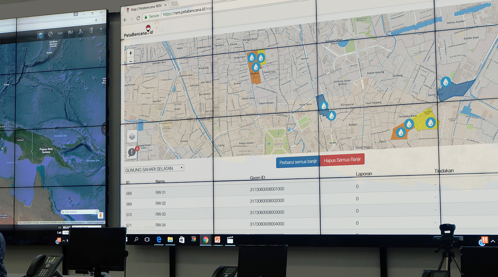
This project, supported by USAID, the Indonesia’s National Agency for Disaster Management and in collaboration with the Pacific Disaster Center at the University of Hawaii, allows residents to share vital flood information using social messaging apps. Confirmed flood reports are added to a publicly available map helping to inform communities and emergency agencies of the flood situation in real-time.
Operating in four cities, Greater Jakarta, Bandung, Surabaya and Semarang, the flood map feeds the crowdsourced data to emergency managers and PDC’s Disaster Management Early Warning platform called InAWARE through a custom-built REM (Risk Evaluation Matrix).
In 2019, This project was handed over to Yayasan Petabencana.
Yayasan PetaBencana : Etienne Turpin, Pritta Andrani Widyanarko, Dika Fadmastuti, Christina Geros, Nashin Mahtani, Emir Hartato.
Supported by: USAID, Badan Nasional Penanggulangan Bencana, Pacific Disaster Center
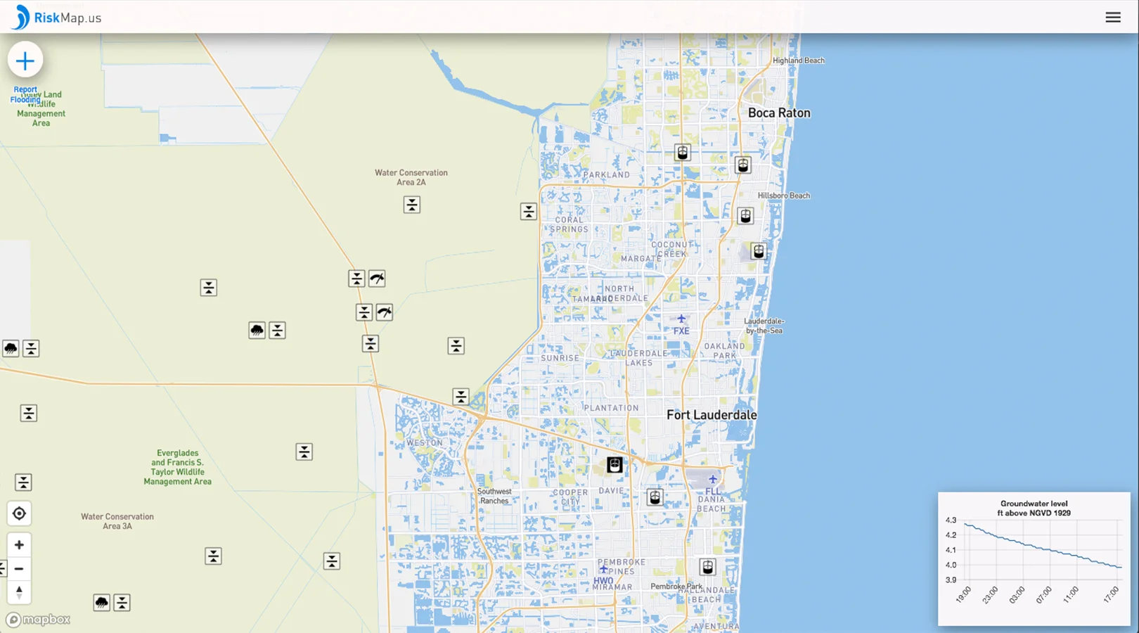
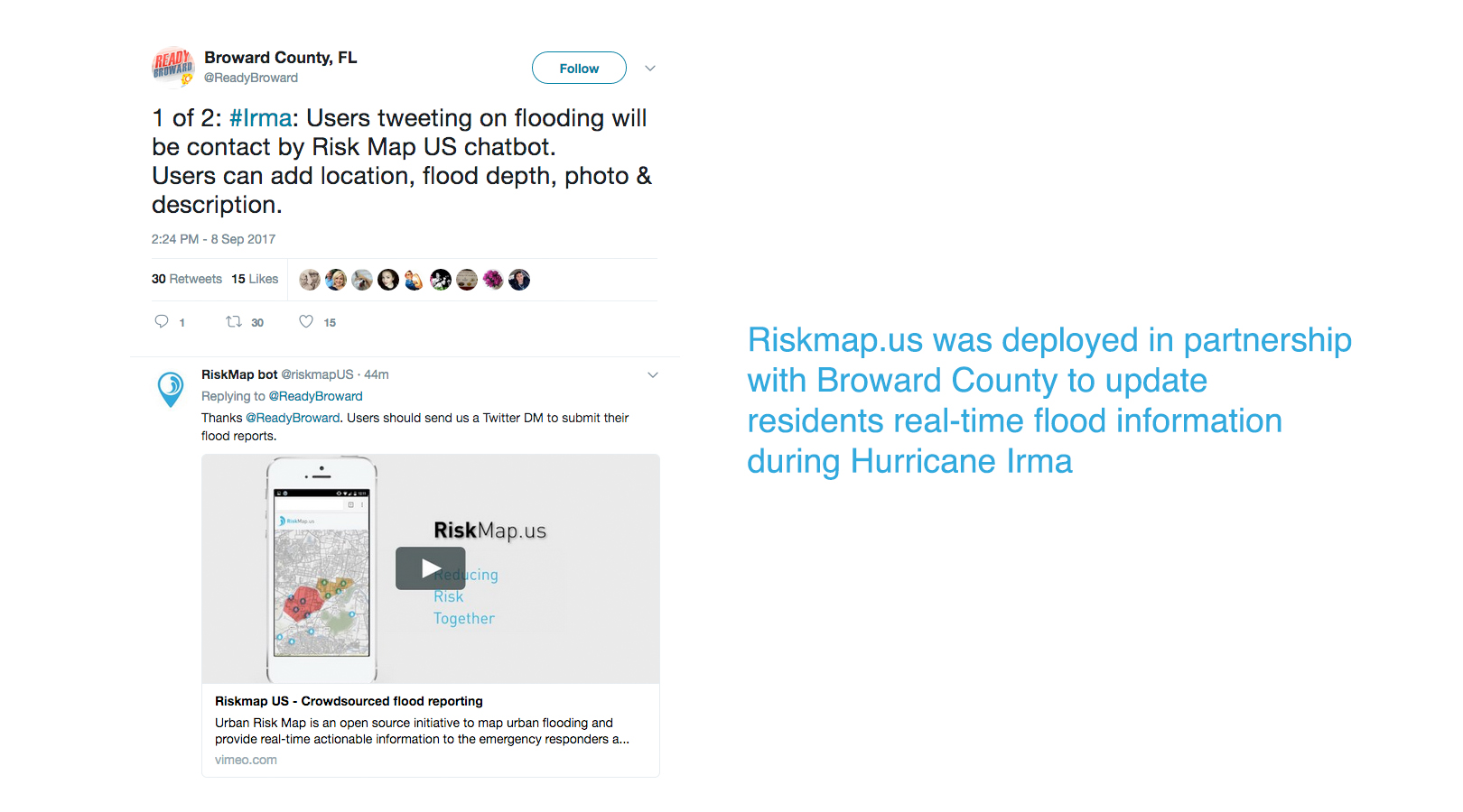
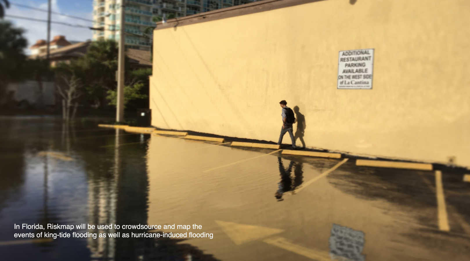
This project, supported by Broward County, had a beta-launch in October to respond to the flooding caused by Hurricane Irma. We will be working with Broward County to fully deploy Riskmap.us for future hurricane induced flooding as well as tidal and sunny-day flood occurrences in Broward county, Florida.
Supported by: Broward County
MIT Urban Risk Lab: Miho Mazereeuw, Tomas Holderness, Matthew Berryman (Across The Cloud), Mayank Ojha, Aditya Barve, Abraham Quintero, Manaasa Priyaa Dharmapuri Sridhar, Evan Owens, Saeko Nomura-Baird, Isreal Macias, Christina Liao, Eakapob Huangthanapan
Published in
Chakrapani, Saranya. “RiskMap App Launched in Chennai to Share Info on Flooding - Times of India.” The Times of India. Accessed November 29, 2017. https://timesofindia.indiatimes.com/city/chennai/riskmap-app-launched-to-share-info-on-flooding/articleshow/61563363.cms.
DESIKAN, ANANYAA. “Chennaiites Rely on Private Social Media Pages for Flood Warnings.” News18. Accessed November 30, 2017. http://www.news18.com/news/india/chennai-locals-relying-on-private-social-media-pages-to-get-weather-flood-updates-1567663.html.
Indonesia, C. N. N. “Pantau Titik Banjir Di Jakarta Lewat Peta Bencana.” teknologi. Accessed September 16, 2021. https://www.cnnindonesia.com/teknologi/20190305082813-185-374546/pantau-titik-banjir-di-jakarta-lewat-peta-bencana.
Kansai TV NEWS. Massachusetts Institute of Technology and Fukuchiyama City, Kyoto Prefecture Collaborate on “Disaster Information Gathering System” for Research, 2021. https://www.youtube.com/watch?v=sO_ia6hV3ac.
Liptak, Andrew. “MIT Is Using Social Media to Map Flooding from Hurricane Irma in Real Time - The Verge,” September 9, 2017. https://www.theverge.com/2017/9/9/16280250/mit-urban-risk-lab-riskmap-hurricane-irma-real-time-crowdsource-flood-reporting.
Mattew, Pheba. “Chennai Rains: Now, a Web-Based App for Citizens to Report Waterlogging in the City.” The News Minute, November 4, 2017. http://www.thenewsminute.com/article/chennai-rains-now-web-based-app-citizens-report-waterlogging-city-71080.
“MIT Map Offers Real-Time, Crowd-Sourced Flood Reporting during Hurricane Irma.” MIT News. Accessed November 30, 2017. http://news.mit.edu/2017/map-real-time-crowd-sourced-flood-reporting-hurricane-irma-0908.
Moon, Mariella. “MIT Is Crowdsourcing Hurricane Flood Maps in Florida.” Engadget. Accessed November 30, 2017. https://www.engadget.com/2017/09/09/mit-riskmap-crowdsource-flooding-hurricane-irma/.
Noveck, Simone. “Opinion | Elections Won’t Save Our Democracy. But ‘Crowdlaw’ Could.” Washington Post. Accessed September 16, 2021. https://www.washingtonpost.com/news/theworldpost/wp/2018/10/02/participatory-democracy/.
“Ryotan Nihon Shimbun: Disaster Response Using AI Fukuchiyama City and Public Universities Joint Research with US МIT | News.” Accessed September 16, 2021. https://www.ryoutan.co.jp/articles/2021/05/91618/.
SCHEMBRI, FRANKIE. “Data Scientists Use Social Media to Map Hurricane Irma’s Flooding,” October 20, 2017. https://www.pbs.org/wgbh/nova/article/data-scientists-use-social-media-to-map-hurricane-irmas-flooding/.
Vijayakumar, Sanjay. “MIT Initiative on Flood Reporting.” The Hindu. November 2, 2017, sec. Chennai. http://www.thehindu.com/news/cities/chennai/mit-initiative-on-flood-reporting/article19965959.ece.
毎日新聞. “水害研究の会議公開 福知山市、米MITとAI活用し /京都.” Accessed September 16, 2021. https://mainichi.jp/articles/20210515/ddl/k26/010/231000c.