


Flux.land is new kind of interactive geo-socio-spatial platform designed to increase awareness and bridge the gap between different stakeholders of urban development through a data-driven, collaborative, web-based toolkit for urban planning and decision making across the scales.
Three-fourths of Florida's population resides in coastal counties with an estimated value of built environment and infrastructure replacement by 2030 to be $3.0 trillion. Moreover, the slow-onset risk of climate change will bring frequent heavy rainfall and hurricane events and ever-increasing king tides. Rising sea level will also impact the saltwater intrusion levels, due to the porous limestone bedrock, threatening the infrastructure in the county. The process of urban change will have to take into account the complex interrelations of climate change induced short and long-term risks by developing innovative design codes, robust approval practices, and resilient development typologies.
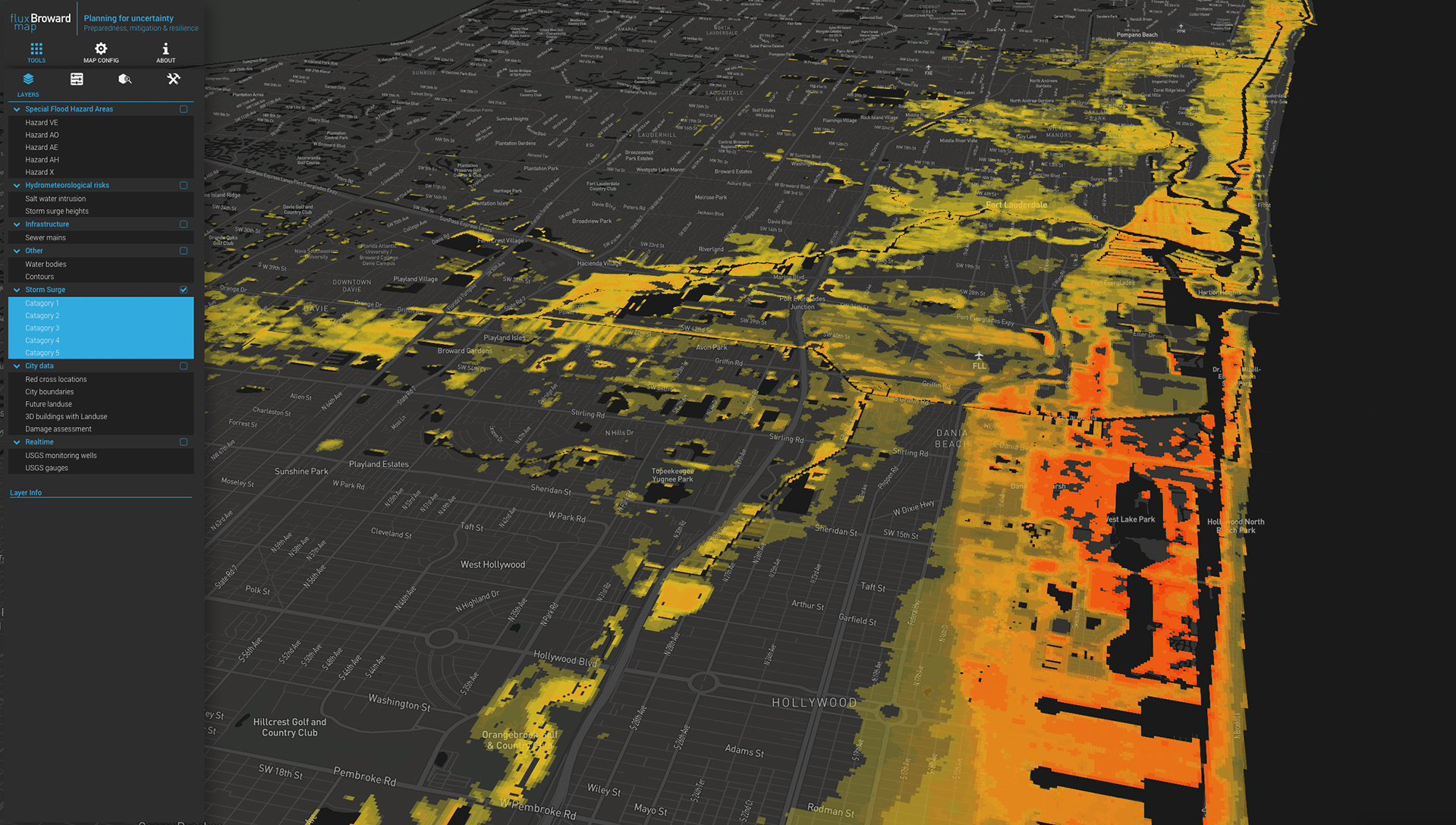
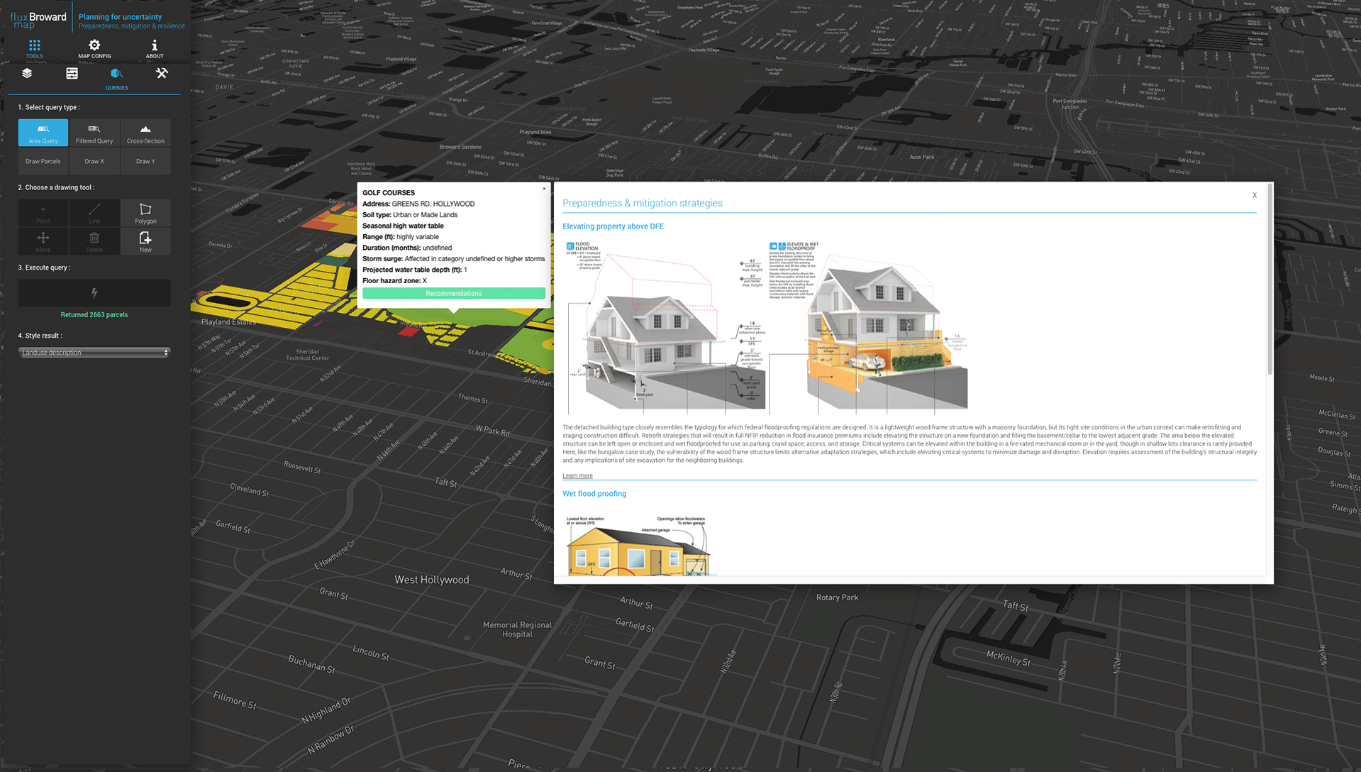
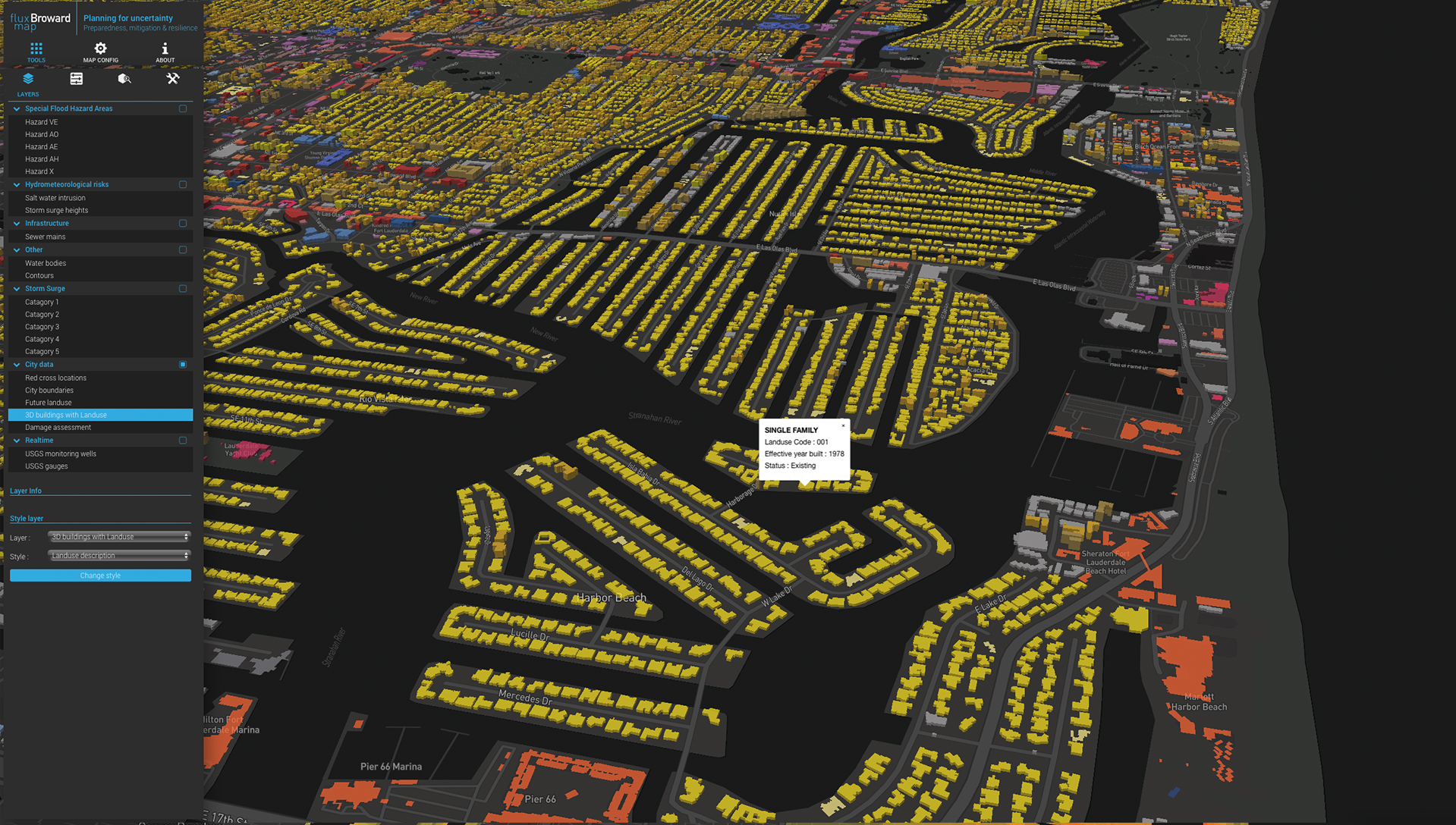
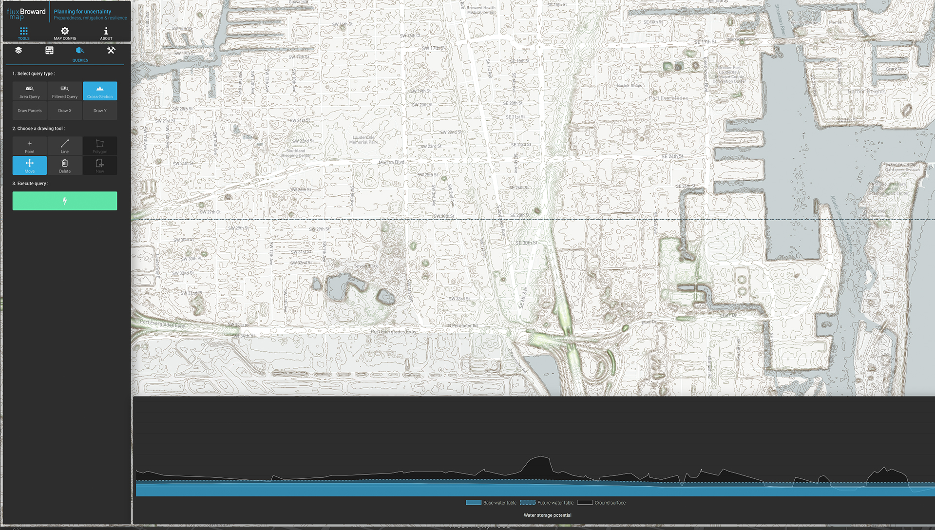
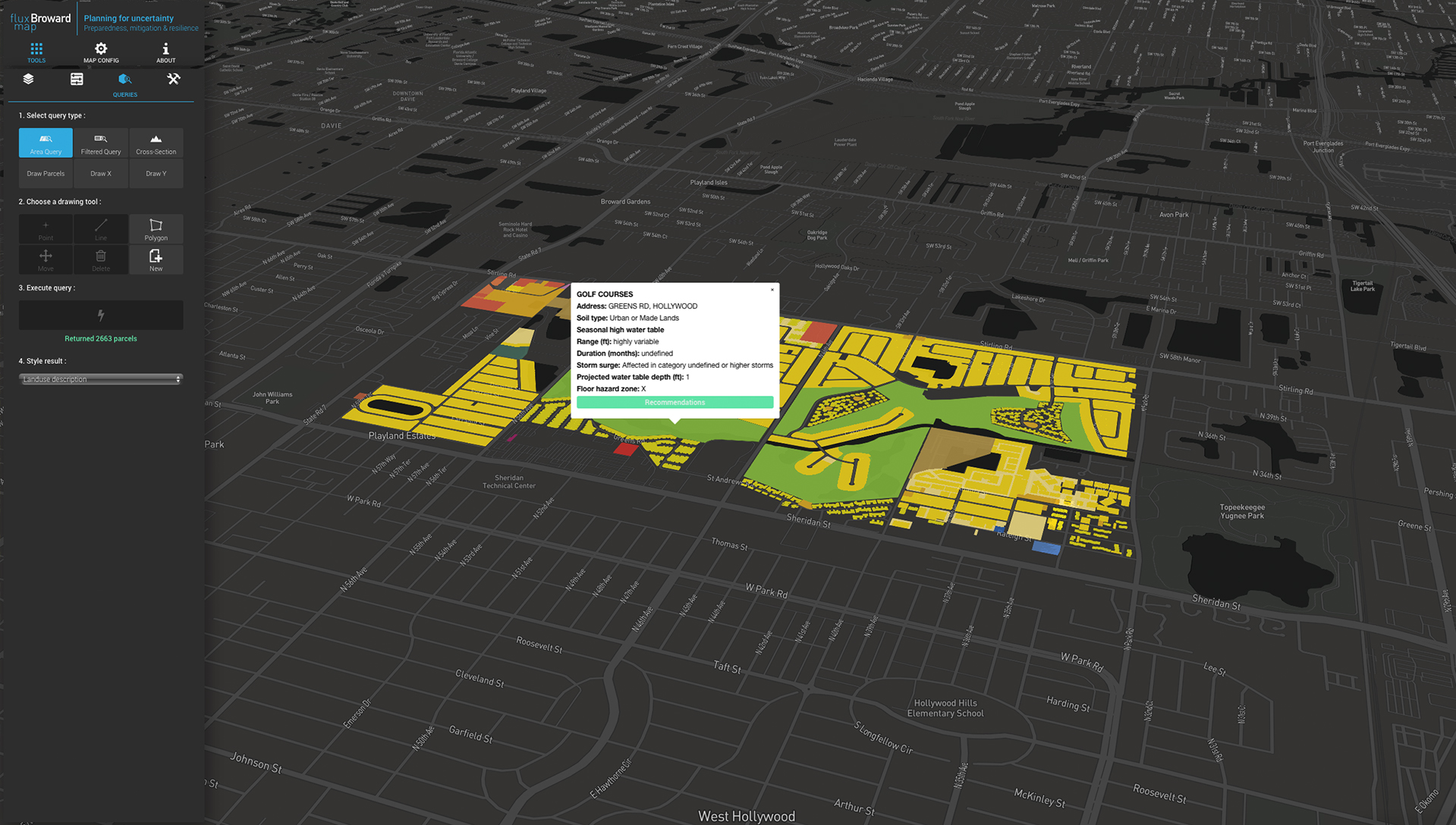
Working with the County Office of Environmental Licensing, our goal is to design and develop a web-based tool for Broward county to understand the potential adaptability of the urban fabric to manage the dynamic hydrological condition, in the face of increased vulnerability due to climate change. This tool will connect planning and policy level data of different county offices as well as citizens and will present a platform for cross-department decision making, participatory planning, and civic engagement. The platform will be a continuously updated multi-scalar web-based map that allows for interactive analysis of the effects of sea level rise on the county's stormwater management, infrastructure condition, development potential, standards for local storage and local drainage and resilient design guidelines for new projects. Since it is web-based, it is quick, easily accessible and we are designing the interface to be simple for residents to access this information. This interactive mapping platform incorporates new codes and to understand the potential adaptability of the urban fabric to manage the dynamic hydrological condition of Broward County, in the face of increased vulnerability due to climate change.
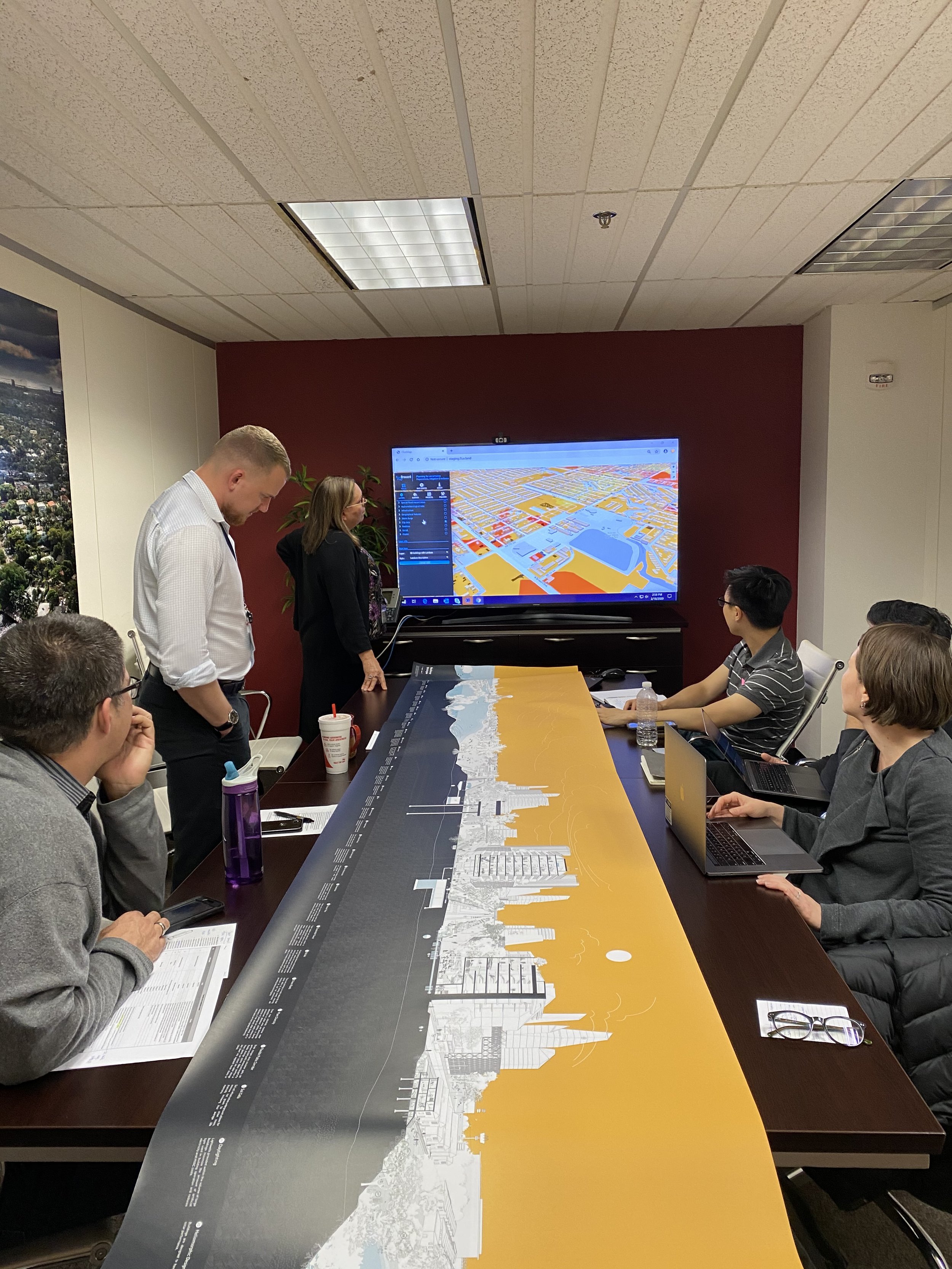
On November 3, 2020, this platform was launched with the collaboration of Broward County Public Schools and is being used within the curriculum to help students understand and explore the local impacts of sea-level rise.
Contributors
MIT Urban Risk Lab: Miho Mazereeuw, Mayank Ojha, Aditya Barve, Abraham Qunintero, Isreal Macias, Kelly Leilani Main, Chetan Krishna.
University of Toronto: Fadi Masoud, Isaac Seah, Joshua Chua, Jia Lu, Fabio Dias
Supported by : Broward County , Sam Tak Lee Case Studies program